
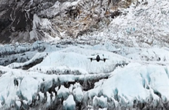
DJI Drone Technology Helps Map Mount Everest’s Deadliest Icefall, Improving Climber Safety

KUALA LUMPUR: DJI has unveiled a new case study demonstrating how advanced drone and mapping technologies were used to survey the hazardous Khumbu Icefall on Mount Everest during the 2026 climbing season, providing mountaineering teams with detailed three-dimensional maps that significantly improved route planning and climber safety.
The project, carried out by Nepal-based drone operator Airlift Technology, combined aerial surveying using the DJI Matrice 4E enterprise drone with DJI Terra mapping software to create high-precision digital models of one of the world’s most dangerous mountaineering environments.
Operating at altitudes exceeding 6,000 metres and temperatures below minus 20 degrees Celsius, the survey captured detailed imagery across more than three square kilometres of the Khumbu Icefall, the treacherous glacier section located between Everest Base Camp and Camp 1.
The resulting data enabled the creation of centimetre-level accurate 3D models that allowed Sherpas, known as the “Icefall Doctors,” to identify crevasses, unstable ice formations, surface movements and safe climbing corridors before entering the glacier.
According to Airlift Technology Chief Executive Officer Raj Bikram Maharjan, the deployment represents one of the first large-scale operational uses of drone mapping technology in Nepal’s high-altitude expedition environment.
He said the technology enables route planners to analyse the icefall remotely, reducing the need for personnel to expose themselves to significant risks during traditional ground surveys.
Historically, Icefall Doctors have been required to traverse the glacier on foot before every climbing season to install ladders, secure ropes and establish the route used by climbers attempting to reach the summit of Mount Everest.
The Khumbu Icefall is widely regarded as one of the most dangerous sections of the ascent due to constantly shifting glaciers, deep crevasses and unstable seracs capable of collapsing without warning.
Using the DJI Matrice 4E, survey flights covering pre-planned routes were completed in approximately three and a half hours, dramatically reducing the time previously required to collect similar information through manual fieldwork.
The imagery was subsequently processed using DJI Terra, which reconstructed the glacier into detailed three-dimensional models employing next-generation technologies, including 3D Gaussian Splatting.
By comparing models collected over different periods, expedition planners were able to monitor glacial movement, identify areas where ice instability had increased and determine the safest locations for installing ladders and fixed ropes.
The technology proved particularly valuable during the 2026 climbing season after a large serac field formed overnight, blocking all established routes leading towards the summit.
According to DJI, the digital models enabled Icefall Doctors to assess changing conditions quickly, rebuild safe routes and restore climbing operations more efficiently than would have been possible using conventional surveying methods.
Beyond improving expedition safety, the project also provides researchers with a valuable digital archive for monitoring long-term glacier movement and environmental change.
Repeated high-resolution mapping is expected to support future scientific studies on glacier thinning and landscape transformation as climate change continues to affect high-altitude mountain environments.
DJI said the initiative demonstrates how drone technology is increasingly being applied beyond commercial imaging, supporting disaster risk reduction, scientific research and safety-critical operations in some of the world’s most challenging environments.